Marsal
History and description
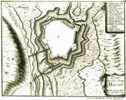
A town of Roman origin, Marsal had its first ramparts built in the 13th century, as a stronghold for control of the salt resources in the region. After having been the property of the bishops of Metz, the town passed into the hands of the Duchy of Lorraine. It was then that the first modern construction took place there, by an Italian engineer named Stabilo and an entrepreneur from Lorraine named Marchal. Disputed by the Kings of France and the Duchy de Lorraine, it was ceded by the Duke of Lorraine to Louis XIV in 1663, who sought to reinforce the links with Metz and Alsace.Vauban set out an initial project for Marsal in 1663. This project remained incomplete in 1679, at the time of his inspections. The porte de France was completely renovated between 1670 and 1676. Work began on four barracks intended to accommodate 1,400 soldiers in 1669 but was not completed until 1705, after their capacity had been reduced, a decision motivated by the installation of a bread-making oven, a military butchery and food stores. This complex was completed with twelve stables, capable of accommodating 290 horses. The lack of wells, due to the presence of brackish water in layers, led to a piping system being drilled in order to supply the town with drinking water. Cisterns were also constructed for storage. A complex of flood defences, supplied by the river of the Seille was installed. A network of coffer dams helped prevent any silting of the land, which were already marshy, when flooding was not contained. Marsal lost its fortifications in 1689 at the start of the War of the League of Augsbourg, at the same time as Stenay and Toul. Vauban was given the task of reconstructing the ramparts during the same war, from 1695. An additional barracks was constructed near a postern, which was reconstructed by Vauban. The other military buildings (governor’s residence and hospice) and the parade ground were constructed from 1625 to 1650.
Following a lack of maintenance during the 18th century, due to the expansion of the frontier, the Restoration reconstructed the Governor’s Residence. Under the July Monarchy, two detached forts were also constructed: the Fort d’Orléans and the Fort d’Harancourt, as well as an arsenal.
Current state
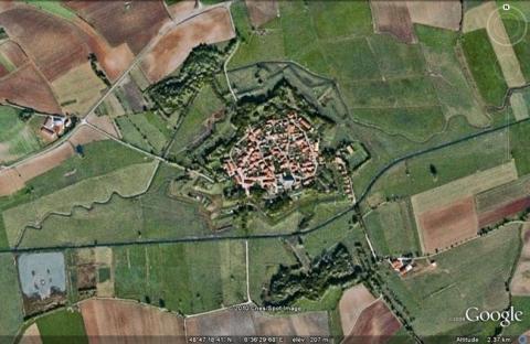
The stronghold was partially dismantled after the Franco-Prussian war. The moats and flood defences may have disappeared but the medians of the ramparts survive, as does the Porte de France. The detached forts are in the same state. Inside, three of the four barracks of the Porte de France still remain, likewise the barracks of the postern. The arsenal of 1848 and the hospice built before Vauban also still stand. The existing barracks have been transformed into rental houses or agricultural buildings. The relief map of 1839 at a scale of 1/600, updated in 1860, is preserved at the musée des Invalides in Paris, but not on show.
Marsal
Marsal
48° 47' 24" N, 6° 36' 35" E
Type
urban wall
Engineers
Jean-Baptiste Stabili, Sébastien le Prestre de Vauban
Department
Moselle
Region
Grand Est
Bibliography
- MARTIN (P.), La route des fortifications dans l’Est, Paris, 2007.
- POULLIN (M.), Les forteresses françaises en 1870-1871. Nos places perdues d’Alsace-Lorraine, Paris, 1890, t. II, p. 366-367.
- SALZMANN (J.-P.), Vauban, militaire et économiste sous Louis XIV, t. I : Vauban et Marsal à l’époque de Louis XIV, le sel, la fiscalité et la guerre, Luxembourg, 2009, (actes du colloque organisé par la Commission Lorraine d’Histoire militaire à Marsal, les 23 et 24 septembre 2007).
- WARMOES (I.), Le Musée des Plans-Reliefs, Paris, 1997, p.41-42.

