Landrecies
History and description
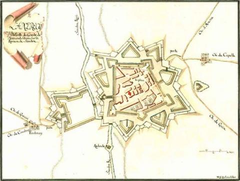
Developed from a Carolingian agglomeration of the 9th century, Landrecies had its first fortifications built in the 11th century, completed by a castle in 1140, separating the upper and lower areas of the town. The first urban wall was replaced in the 14th century by a stone wall. This urban wall did not prevent the town from falling in 1477 to Louis XI of France. Following its recapture by the Netherlands Burgundians, the third urban wall was constructed, including square towers. The initial adaptations made to the modern fortifications were realized between 1526 and 1543 by the Spanish, but proved insufficient against the French in 1543. A fourth urban wall, this time half-bastioned, was constructed by the Italian engineer Giralamo Marini, under the orders of Francis I. Retroceded in 1545 to Charles Quint, Landrecies was reinforced by the Spanish up until 1655. The five arrow-headed bastions were preserved, then upgraded with reinforced curtain walls and dry moats. The exterior sections were also created, as well as the ravelins. In 1655, the town was again under siege by the French, following which it became a permanent part of France under Louis XIV. This joining was also confirmed by the treaty of Pyrenees in 1659.Vauban was urgently summoned in around 1660 to improve the defences. His project consisted of renovating the external moats, which he replaced with deeper ditches. A vast hornwork was also constructed to defend the Low Town. This construction was completed during the war of the League of Augsbourg in 1692. It should be noted that Landrecies has been part of the first line of the Pré Carré since 1678.
Current state
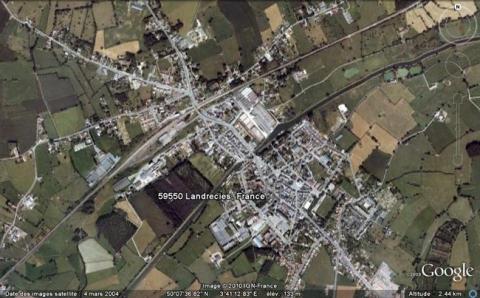
Nothing more than a barracks remains at Landrecies. In fact, all the fortifications were demolished after 1894 and replaced by avenues. The destruction caused in the two world wars also ruined the rest of the ancient structures. A centre of interpretation was opened in the old wheat hall. The relief map remains and is preserved at the musée des Invalides of Paris.
Landrecies
Landrecies
50° 7' 35" N, 3° 41' 27" E
Type
urban wall
Engineers
Girolamo Marini, Sébastien le Prestre de Vauban
Department
Nord
Region
Hauts-de-France
Bibliography
- BRAGARD (P.), CHEUVA (P.), COMBEAU (Y.), (et alii), Étoiles de pierre. Voyage en Nord Pas-de-Calais, Villeneuve d’Ascq, 2003.
- FOURNEZ (P.), Histoire d’une forteresse. Landrecies d’après des documents inédits, Paris, 1911.
- Ouvrage collectif, Septentrion, le guide : entre Mer du Nord et Meuse, 19 villes fortes s’unissent pour inventer un idéal urbain, s. l., 2008, p. 40-41.
- WARMOES (I.), Le Musée des Plans-Reliefs, Paris, 1997, p.38.

