Auxonne
History and description
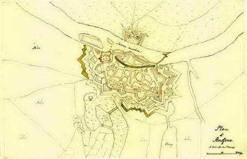
Medieval town situated on the left bank of the Saône, which has had its own castle from 1170, and a urban wall from the 13th century onwards. This first castle was renewed under Louis XI of France. Charles VIII and Louis XII worked on improving the castle and ordered reinforcements and repairs to the urban wall of the 13th century. During the Thirty Year war (1618-1648), bastions and two ravelins were constructed in front of medieval towers, which had been levelled to the ground. Under Louis XIV, plans were laid for an initial project to transform this urban wall into a bastioned fortification from 1668 but ultimately did not come to fruition. It would not be until 1673 that d’Aspremont, as head engineer, finally succeeded in reconstructing the urban wall in question. The walls and medieval towers were almost all demolished except the tour de Dignoire and the tour du Moineau, and the porte de Dignoire, the porte de Dampnot and the porte de Comté. D’Aspremont continued with work involving the modernisation of the urban wall up until at least 1677. Vauban eventually took his place and completed the urban wall in 1679. After d’Aspremont passed away, Vauban set an improvement drive in motion by adding two hornworks: the first of which to the west, on the right bank of the Saône, and the second to the north. However, this project was not completed following the pulling back from the border. In 1687, he joined forces with the engineer De la Frézelière to set up an arsenal which was completed in 1689.The Ecole Militaire of artillery at Auxonne was set up in 1759. It was installed within the arsenal of 1689, within which additional barracks were also built. A final round of bastioned fortification was completed during the period 1826 to 1830. The ramparts were repaired after the two sieges of 1814 and 1815, a medieval curtain wall was replaced by a tenaille with chamber and an infantry barracks, on "rue du Huitième Chasseur".
Current state
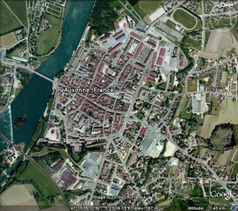
One part of the ramparts still remains and has been turned into a municipal park. The demolitions of 1895 put paid to the walls along the river and the fronts to the west and south-west. The castle (known as château Prost) also remains to the south of the town, and likewise the bastion du Moineau, in the vicinity. The relief map of the town, dated from 1677, repaired and updated in 1771, brings the missing parts of the walls into focus. This plan is kept in Paris. Auxonne is not the most prominent example of Vauban’s work, since the fundamentals were carried out by the engineer d’Aspremont.
Auxonne
Auxonne
47° 11' 37.1432" N, 5° 23' 17.8634" E
Type
urban wall
Department
Côte d’Or
Region
Bourgogne-Franche-Comté
Bibliography
- GRASSET (M.), Vauban… et la Franche-Comté, Saint-Léger-Vauban, 1996, éd. Les Amis de la Maison Vauban.
- Vauban et ses successeurs en Franche-Comté. Trois siècles d’architecture militaire, Besançon, 1981, éd. Association Vauban.
- Guide illustré d’Auxonne, Dole, 1969.

