Cammazes
History and description
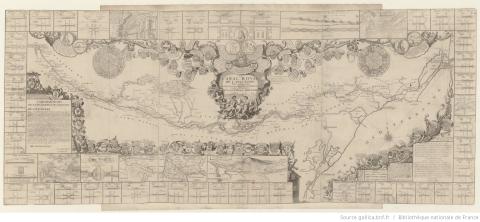
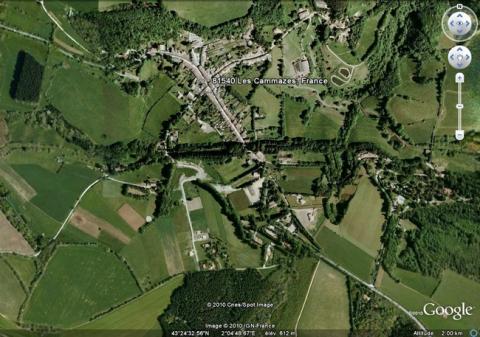
The site of Cammazes is linked to the canal du Midi between the Garonne and the Aude via two of their respective tributaries: the Hers for the Garonne and the Fresquel for the Aude. This canal, a significant 17th century work, was intended to link the Mediterranean to the Atlantic Ocean. The problem of how to ensure an adequate water supply arose very quickly, particularly in terms of the linkage between the two hydraulic basins. Pierre-Paul Riquet, designer of the canal, had the idea of supplying water to the canal by diverting the streams of the Black Mountain of Languedoc. This mountain is situated along the line separating the bodies of water between the hydrographic basins of the Garonne and the Aude. The idea was to create a reservoir along the Sor (a local stream). This reservoir was intended to supply the canal du Midi via a system of aqueducts, at the level of the écluse de l’Océan (lock of the Ocean), situated at the crossing point of the line separating the bodies of water by the canal. The aqueduct was called rigole du Laudot, later renamed rigole de la Plaine. Riquet presented this project in 1662. In order to convince those making the decisions, he himself fashioned a gully on the site in 1665. During the preliminary discussions, the Knight of Clerville was consulted on the question of the output in Bas-Languedoc. Louis XIV finally decided to commence construction including drilling from 1666. The initial phase of the construction involved dams and expropriations. The first stone was laid in November 1667. Despite numerous difficulties, the construction was already well underway when Riquet passed away in 1680. The engineer La Feuille then took up the project and successfully drilled the canal, which was then opened in 1683.Vauban worked there from 1686. Following an inspection, he could see the construction was already in decline and required improvements. With this in mind, he started work at Cammazes: he oversaw a drilling project which saw the rigole de la Montagne Noire (Black Mountain gully) opened and reinforced the barrage of Saint-Férrol. The construction was completed in 1692. For the remaining part of the route, he strove to ensure the canal was independent of the bodies of water he crossed via canal-bridges and new locks where necessary. If they were already in place, he improved them. The engineer Niquet continued in the same vein up until 1726.
Current state
The canal du Midi still exists, likewise the reservoirs and gullies of Cammazes. The entire set is today protected as a historical monument. The reservoir is still used by Voies Navigables de France (Navigable Routes of France) and can be visited. The canal du Midi was inscribed on the World Heritage List in 1996.
Cammazes
Cammazes
43° 24' 41.0933" N, 2° 4' 43.7329" E
Type
hydraulic construction
Engineers
Pierre-Paul Riquet, Louis-Nicolas de Clerville, Alexis de La Feuille de Merville, Sébastien le Prestre de Vauban, Antoine Niquet
Department
Tarn
Region
Occitanie
Bibliography
- ADGE (M.), « Vauban et le Canal du Languedoc » in Vauban et ses successeurs dans les Pyrénées, Paris, 2003, p.179-208.
- COTTE (M.), Le canal du Midi, « merveille de l’Europe », Paris, 1998.
- FAUCHERRE (N.) et RIBIERE (H.), La route des fortifications en Méditerranée, Paris, 2007.
- LE PRESTRE DE VAUBAN (S.), « Mémoire sur le canal du Languedoc » in Les oisivetés de Monsieur de Vauban, Seyssel, 2007, p.145-185.
- Ouvrage collectif, Un canal…des canaux…, Paris 1986, (catalogue d’exposition).
- PINON (P.), Canaux, rivières des hommes, Paris, 1995.
- PINON (P.), « Les canaux de navigation et l’aqueduc de Maintenon » in Vauban, bâtisseur du Roi-Soleil, Paris, 2007, p.207-213.
- VIROL (M.), Vauban et les voies d’eau, Paris, 2007.

