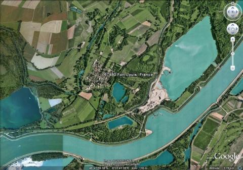
Fort-Louis
History and description
Fort-Louis-du-Rhin is one of the new French towns entirely created by Vauban. It included a garrison, and depots for equipment and munitions to supplement the defence of other existing Alsace locations (Strasbourg situated upstream and Philipsbourg downstream, just two examples of the closest locations). The town was founded on an isle of the Rhine, in a spot lacking any bridge or crossing point. Vauban designed the town in an orthogonal shape, laid out to follow the direction of the river current and the isle itself (extended from south-west to north-east), surrounded by a bastioned protective wall comprising seven relatively flat bastions and two hornworks, each including two bastions, a ravelin in the inner fortified structure and a glacis towards an incoming parade ground. The centre itself was taken up by a citadel. This citadel was square shaped, with four bastions, four ravelins and a covered way including prominent parade grounds. The two gates of the ramparts are on the level of this citadel, which is preceded by an esplanade leading towards the two zones of the interior. Two hornworks were constructed on the left and right banks of the river in order to protect the bridges and gates of the new town. These hornworks were flanked with demi-bastions, a ravelin and a triangular inner fortified structure. The citadel also housed a small parade ground, surrounded by seventeen barracks buildings, a chapel, officers’ quarters and shops. The construction got underway in 1686 and was completed in 1690. The town rapidly expanded but only the southern part of the isle was inhabited in around 1700. The northern portion had not yet been constructed at this time.In 1697, the treaty of Rijswick compelled France to dismantle the hornwork situated on the right bank of the Rhine.
Current state
Hardly anything remains today of Fort-Louis-du-Rhin. The stronghold was largely destroyed after a Prussian siege in 1793. The urban wall and fort were also all but demolished in the 19th century, under the Restoration and during the channelling of the Rhine. Currently, all that remains are the banks, the moats and some portions of the citadel wall, with all the interior buildings having disappeared. Of the urban wall, all that remains are a few traces of banks and rows of trees to the north. The two tributaries of the Rhine which surrounded the isle dried up, the river flowed a further kilometre eastwards to the agglomeration, which was no longer anything more than a village and of which only the orthogonal outline remained.
Fort-Louis
Fort-Louis
48° 48' 7" N, 8° 3' 26" E
![Fort-Louis-du-Rhin, plan avant 1700, dans Cartes des environs de plusieurs places entre la Moselle et le Rhin, [Paris], pl. 20, gallica.bnf.fr / Bibliothèque nationale de France. Fort-Louis-du-Rhin, plan avant 1700, dans Cartes des environs de plusieurs places entre la Moselle et le Rhin, [Paris], pl. 20, gallica.bnf.fr / Bibliothèque nationale de France.](/sites/default/files/styles/paragraphe_libre/public/images/plan_ancien-60.jpg?itok=0JvtbDK9)
