Sedan
History and description
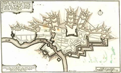
A town which came into being in the 10th century, equipped with a castle since the 13th century, Sedan was integrated into French territory for the first time under Charles IV. Charles VI ceded it to the princely family De la Marck in 1424. Evrard III De la Marck transformed the castle into a citadel, around which the town developed bit by bit. From 1440 to 1487, the citadel was given a new outer bailey to the north. This was equipped with hemispherical artillery towers and an artillery rampart, while the curtain walls were thickened using internal earthworks. Other similar constructions were carried out from 1495 to 1521. The citadel had its first modern works built between 1553 and 1572, when the family De la Tour d’Auvergne, also known as De Turenne, received Sedan and the independent principality it had become under Henri II. The angles of the former castle included four irregular bastions. Under Henri III, the town was surrounded by a urban bastioned wall in 1577. Henri IV and the De Turenne improved the system of fortifications designed by Errard de Bar-le-Duc. During this period, the citadel lost its primitive function of a princely residence to instead become solely a military installation. The town and its principality were definitively passed onto France under Richelieu and Louis XIII in 1642.Vauban intervened in Sedan from 1680. There, he modified the route of the urban wall, improved the defences of the citadel, added hornworks to the exterior and constructed barracks. The construction ended around 1697.
Current state
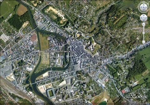
The citadel still survives, likewise the barracks and the hornwork known as Palatinat on its north-west flank, and can be visited. A hotel occupies the barracks. Numerous activities, including medieval-type shows, falconry shows and “son et lumière” sound and light programmes are regularly organised there. The urban wall was demolished after 1870, after it had been partially destroyed during the Prussian siege of the month of October during which Napoleon III was held prisoner. The relief map at a scale of 1/600, constructed in 1841, repaired in 1853 and 1964, is preserved at the musée des Plans Reliefs (museum of Relief Maps) in Paris but is not on show.
Sedan
Sedan
49° 42' 12.1532" N, 4° 56' 36.0272" E
Type
citadel and urban wall
Engineers
Jean Errard de Bar-le-Duc, Sébastien le Prestre de Vauban
Department
Ardennes
Region
Hauts-de-France
Bibliography
- FAUCHERRE (N.), Places fortes, bastions du pouvoir, Paris, 2000.
- MARTIN (P.), La route des fortifications dans l’Est, Paris, 2007.
- Ouvrage collectif, Le château fort de Sedan, Colmar, 1977.
- WARMOES (I.), Le Musée des Plans-Reliefs, Paris, 1997, p.39.

