Bouchain
History and description
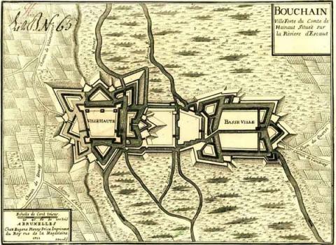
A town founded in the 7th century where the Escaut and Sensée rivers meet, Bouchain has had ramparts since the 12th century. It is divided into two main parts: a lower town defended by a moat and a fortified raised town, which is equipped, thanks to Baudouin IV of Hainaut, with a keep, the tower of Ostrevent, dating from 1164. The first modern constructions took shape under Charles Quint, who added four orillon bastions at the upper town in 1532; six years after the town had been taken by the Dutch. The medieval defence system employing water was also improved at the same time.In 1676, the town was taken by France. Vauban then included it in the Pré Carré. He improved the outside and the flood defences, remodelled the medieval keep and constructed a barracks and a powder keg. In 1682, he recommended downgrading Bouchain, considering it of no use. However, he published a second blueprint in 1691. The value of this second project was amply demonstrated in 1712 when the town was besieged and taken by the Duke of Marlborough, during the war of Succession of Spain, only to be retaken by France the following year. The earth front of the upper town was equipped with a counterscarp gallery for back fire and countermines. A supplementary casemate was constructed in the 19th century.
Current state
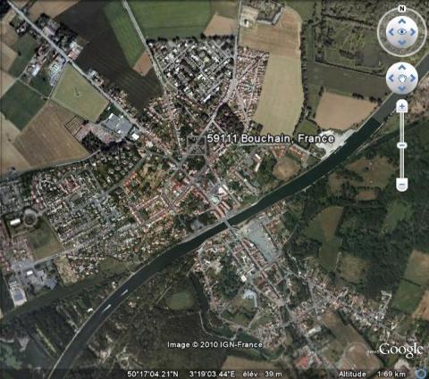
The ramparts of Bouchain were dismantled in multiple phases, between 1837 and 1893. The town was seriously damaged during the First World War. Of the set of defensive installations described, all that is left is the Ostrevant tower from 1164 modified by Vauban, the powder keg of 1687, the bastion des Forges with part of the curtain wall of the 16th century, tunnel galleries, two rooms under the Timothée Trimm square, a site of the 19th century and the old moats of the fortifications in the low town. These vestiges van be visited by contacting the tourist office. The relief map of 1715 at a 1/600 scale, repaired in 1769 and 1920, is preserved at the musée des Beaux Arts (Fine Arts museum) of Lille.
Bouchain
Bouchain
50° 17' 4" N, 3° 19' 4" E
Type
urban wall
Engineers
Sébastien le Prestre de Vauban
Department
Nord
Region
Hauts-de-France
Bibliography
- BRAGARD (P.), CHEUVA (P.), COMBEAU (Y.), (et alii), Etoiles de pierre. Voyage en Nord Pas-de-Calais, Villeneuve d’Ascq, 2003.
- CORVISIER (C.), « La tour d’Ostrevant à Bouchain. Un donjon de type anglo-normand au comté de Hainaut » in Bulletin monumental, t. 157, 1999.
- FAUCHERRE (N.), HANSCOTTE (F.), La route des villes fortes en Nord, Paris, 2005.
- Ouvrage collectif, Septentrion, le guide : entre Mer du Nord et Meuse, 19 villes fortes s’unissent pour inventer un idéal urbain, s. l., 2008, p. 24-25.
- SALAMAGNE (A.), Vauban en Flandre et en Artois : les places de l’intérieur, Saint-Léger-Vauban, 1995.
- WARMOES (I.), Les plans en relief des places fortes du Nord dans les collections du Palais des Beaux-Arts de Lille, Lille-Paris, 2006.
- WARMOES (I.), Le Musée des Plans-Reliefs, Paris, 1997, p.34.

