Condé-sur-l’Escaut
History and description
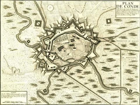
A town of Gallo-Roman origin, Condé did not really start developing until around 1000 A.D., when canons set up there and skippers began to engage in commerce. A castle was added by the Lord of Avesnes between 1147 and 1170, in the form of a keep with skirt section. The count of Flanders Baudouin V surrounded the town with its first urban wall in 1184. The start of the 13th century saw the castle replaced with another, of the Philippien type. In 1654, the Spanish set in motion a modern construction drive, which was interrupted when the French took over in 1655, only for the land to be recaptured by the Spanish the following year. The Spanish added a covered way and constructed advanced defences. The medieval urban wall was partially replaced by modern earthworks. One side was completely reconstructed using this technique. In 1676, Louis XIV besieged the town, which was taken permanently by France, as was confirmed two years later by the treaty of Nimègue.Included in the first line of the Pré Carré, Condé was visited by Vauban, who improved the town defences. Redoubts and terraced bastions were added in front of the Spanish urban wall which was made of stone. A new covered way and six redoubts were constructed to convey the water and the main plateau. The dry ditches made of earth included countermines. The most significant construction involved the hydraulic defences. Water was collected and redistributed by a system of twenty-seven locks and eight coffer dams, which allowed areas to be flooded within twenty-four days.
Other work would follow in the 18th century. Around 1793-1794, when Austrians upgraded the countermines under the ravelin of Tournai.
Current state
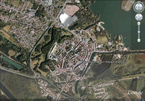
The northern and western half of the bastioned urban wall still remains: namely the bastion de Jard, bastion de Solre, bastion de Teste and bastion de Tournai. The ravelin of Tournai and its countermines were also preserved, as well as the porte de Vautourneux. This entire set has now been made to form a city park. To the east, moats are also well preserved. To the south, the arsenal of the rue de l’Escaut is the last remaining remnant of the southern and eastern urban wall, which was demolished in 1931. However, remains of the walls and towers from medieval and modern periods remain visible between the contemporary constructions. The building work carried out on the locks was also preserved, although the latter are no longer functional. None of the remains of the urban wall have been maintained or evaluated. The castle has been excavated by archaeologists from the University of Amiens since 2000. For visitor access to all the remains, please contact the local tourist office.
Condé-sur-l’Escaut
Condé-sur-l’Escaut
50° 27' N, 3° 35' 29" E
Type
urban wall and hydraulic defence
Engineers
Sébastien le Prestre de Vauban
Department
Nord
Region
Hauts-de-France
Bibliography
- BRAGARD (P.), CHEUVA (P.), COMBEAU (Y.), et alii, Etoiles de pierre. Voyage en Nord Pas-de-Calais, Villeneuve d’Ascq, 2003.
- FAUCHERRE (N.), HANSCOTTE (F.), La route des villes fortes en Nord, Paris, 2003.
- Ouvrage collectif, Septentrion, le guide : entre Mer du Nord et Meuse, 19 villes fortes s’unissent pour inventer un idéal urbain, s. l., 2008, p. 32-33.

