Douai
History and description
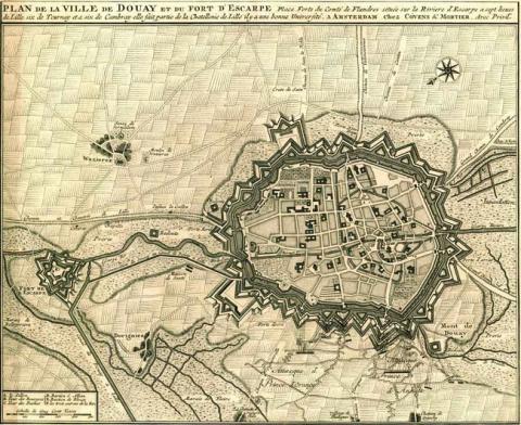
The town of Douai had its first modern defensive works built in the 17th century. The urban wall of the 14th-15th century has been preserved but levelled out and improved by the addition of a glacis, nineteen earth ravelins and the fort de Scarpe, a pentagonal earth structure, downstream of the town and outside the urban wall. The latter allows floods to be controlled downstream.Besieged by the French on 2 July, 1667 during the war of Devolution, (siege directed by Vauban) Douai capitulated on 6 July. Vauban proposed simple improvements: reinforcing the ramparts at the river exit, remaking the entrance gate to the river, improving the angled flanking of the urban wall, elevating and building ravelins. In 1693, twenty-four external constructions existed, of which five were stone-built ravelins. The projects were performed during the 18th century: with a total of sixty exterior stone constructions in 1785. Louis XIV had the fort de Scarpe built, despite the opposition of Vauban. The construction started in 1670, directed by the engineer Chazerat, and was completed in 1672. The engineers Simon Vollant and Mesgrigny also worked on the project. After this construction, the fort retained its pentagonal shape and was given three stone ravelins, barracks, powder stores, officers’ quarters and a chapel, all made of stone.
Current state
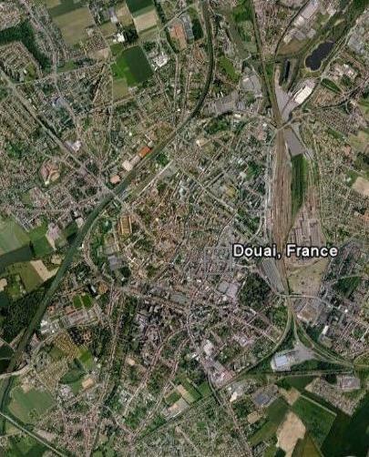
Today, nothing remains of the constructions of the reign of Louis XIV. Downgraded in 1889, the fort and the ramparts were entirely demolished to make room for transport arteries, a railway station and a canal, that of the Scarpe. Only three medieval remains still stand. The relief map, constructed in 1709 to a 1/600 scale and purchased by the town in 1904 is preserved in the municipal museum known as la Chartreuse. The route of the ramparts can be appreciated by following the avenue which were constructed over their original positions. The location of the fort de Scarpe, meanwhile, is today occupied by an exhibition hall and a public park, le parc du Rivage Gayant (the park of Rivage Gayant).
Douai
Douai
50° 22' 17" N, 3° 4' 48" E
Type
urban wall
Engineers
Sébastien le Prestre de Vauban, Simon Vollant
Department
Nord
Region
Hauts-de-France
Bibliography
- BUFQUIN (V.), Histoire de Douai, Douai, 1951.
- Ouvrage collectif, Douai, son histoire militaire et ses fortifications, Douai, 1892.
- SALAMAGNE (A.), Vauban en Flandre et Artois, les places de l’intérieur, Saint-Léger-Vauban, 1995.
- SALAMAGNE (A.), Construire au Moyen Age. Les chantiers de fortification de Douai, Septentrion, Lille, 2003.

