Fort-les-Bains
History and description
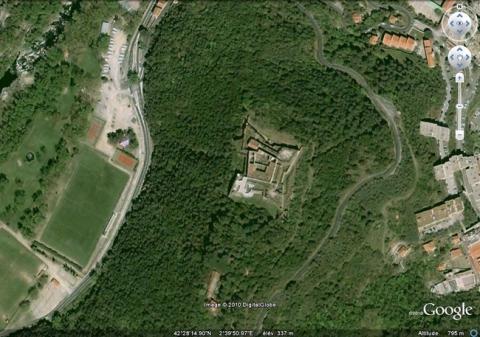
Situated on a hill that dominates the confluence of the Tech and the Montdony, the fort-les-Bains was constructed from 1670 on the orders of the Count of Chamilly to defend the town of Amélie-les-Bains and the road of Prats-de-Mollo. The tour des Bains, of medieval origin, was demolished to make room for this fort. The engineer Saint Hillaire designed the plans and ensured follow-up of the construction. This fort was constructed in a square shape with a bastion at each angle. The covered way was added in 1674, during the war of Holland, which saw its construction interrupted following a Spanish siege. During his second passing through the Pyrénées in 1679, Vauban made some improvements but did not consider the complex to be a top priority.A project was set out in 1888 to improve the defences but remained on the drawing board.
Current state
The fort has been classed as a historical monument since 1909 and been open to visitors. The relief map of the fort is preserved at the musée des Invalides in Paris.
Fort-les-Bains
Fort-les-Bains
42° 28' 15" N, 2° 39' 52" E
Type
fort
Engineers
Noël Bouton de Chamilly, Jacques de Borelly de Saint-Hilaire, Sébastien le Prestre de Vauban
Department
Pyrénées-Orientales
Region
Occitanie
Bibliography
- AYATS (A.), Les fortifications de Vauban. Découverte guidée en pays catalan, Canet, 2007.
- FAUCHERRE (N.), La route des fortifications en Méditerranée, Paris, 2007.
- WARMOES (I.), Le Musée des Plans-Reliefs, Paris, 1997, p.54.
- Site internet du Ministère de la Défense, Chemin de mémoire : www.cheminsdememoire.gouv.fr
![Fort-les-Bains, plan de 1693, dans Recueil des plans des environs de plusieurs places du Royaume faits en l’an 1693, [Paris], pl. 45, gallica.bnf.fr / Bibliothèque nationale de France. Fort-les-Bains, plan de 1693, dans Recueil des plans des environs de plusieurs places du Royaume faits en l’an 1693, [Paris], pl. 45, gallica.bnf.fr / Bibliothèque nationale de France.](/sites/default/files/styles/paragraphe_libre/public/images/plan_ancien-88-r270.jpg?itok=0zvaHAN3)
