Brouage
History and description
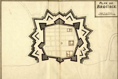
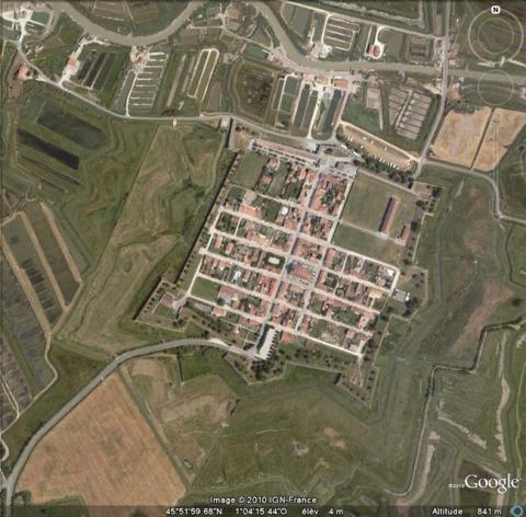
Situated in a zone of salt rock and occupied since the 11th century, Brouage, which was originally known as Jacopolis-sur-Brouage, was founded in 1555 by Jacques de Pons as a centre of negotiation for salt, and without any military intention. All that surrounded the town was a single urban wall of earth and wood. However, the Religious wars and the sieges of La Rochelle meant that Brouage, situated as it was next to the sea, became a strategic hub for the control of the Charente salt. It was taken tower by tower by the Catholics and Huguenots and given its first bastioned fortifications at this time (constructed in 1569 by Robert de Chinon). Henri III designated it as a royal town in 1578. It was also at this period that the route of the fortifications was permanently fixed: an orthogonal square surrounded by a urban wall with seven bastions. A ravelin was adjacent to one of the flanks. The bastions were distributed as follows: four at angles and three at the centre of the north, east and south sides (the latter of which intended to protect each of the three gates of the urban wall respectively). To stabilise the subsoil, the town was constructed on wooden sills. Eight years later, the Rochelle people sunk the ships to ruin the port, which would never again be totally clear. In 1626, the Cardinal of Richelieu became governor of the town which then adopted his own name. He ordered significant constructions during the period from 1628 to 1640, the on-site management of which fell to the engineer Pierre de Conti, Lord of Argencourt. A barracks, a food hall, powder kegs and a royal forge were also constructed. On the exterior, he applied a coating of dressed stone to the walls of Robert de Chinon. These walls were also had a brick parapet applied.In 1685, the engineer Francis Ferry, colleague of Vauban, modernised the bastions and the peripheral walkway, aiming to upgrade a location which Vauban deemed to be more crucial than Rochefort as an arsenal. He reconstructed the guardroom and got rid of the outside part. The programme of Ferry, according to which water would be channelled back to a part of Brouage, remained incomplete. Only the southern half of the town was able to benefit.
Current state
The urban wall and the town-planning map of Brouage are preserved almost entirely, the town was completely demilitarised in 1885. There is still a barracks, a powder keg, the royal forge, the food hall and the hangars of the curtain wall of the northern front. All these buildings can be visited freely or with a guide by contacting the tourist office, which offices are in the restored royal forge. The only areas destroyed are the northern urban wall where a gap in the road is visible near the gate.
Brouage
Brouage
45° 51' 58.9579" N, -1° 4' 12.2711" E
Type
urban wall (new town)
Engineers
Jacques de Pons, Robert de Chinon, Pierre de Conti d’Argencourt, François Ferry, Sébastien le Prestre de Vauban
Department
Charente-Maritime
Region
Nouvelle-Aquitaine
Bibliography
- CROCHET (B.), RIVET (G.), Vauban et son héritage, Guide des forteresses à visiter, Rennes, 2014, p.107-108.
- FAUCHERRE (N.), Bastions de la mer. Le guide des fortifications de la Charente-Maritime, Chauray-Niort, 1994.
- LE BLANC (F Y), FAUCHERRE (N.), La route des fortifications en Atlantique. Paris, 2007
- Ouvrage collectif, Vauban et ses successeurs en Charente-Maritime, Paris, 1997.

