Embrun
History and description
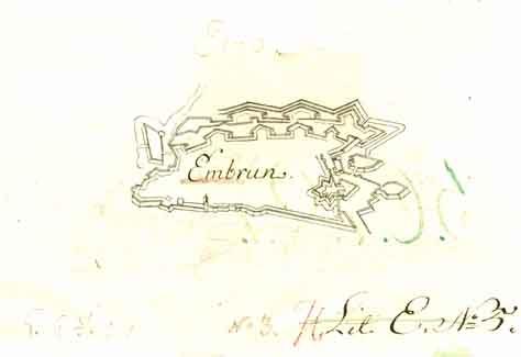
Agglomeration of Gaulish origin, then a Roman military post, Embrun was the seat of an archbishopric from the 4th century up to the French Revolution. The prelates of this archbishopric, temporary lords of the town, constructed the first city fortifications in order to repel the numerous invasions to which the town was subject over the centuries (Lombard, Hun, Moor, etc.). In the 14th century, the Dauphins (sovereigns of the independent principality of Dauphiné) possessed a fortified palace in the town. This palace was transformed into a citadel after the annexation of the principality in the kingdom of France in 1349. Subsequently, the wars of Italy and the wars of Religion went on to devastate the town, which was finally taken by the protestant Lesdiguières in 1585 and ruined. Under the protestant administration, it became a place of surety for the reformed cult. In 1599, the citadel was demolished on the orders of Henri IV. The urban wall was preserved and restored. In the 17th century, Embrun thus had a double urban wall, which was equipped with nine bastions and a ravelin.However, this urban wall did not succeed in 1692 in repelling the attacks of Duke Victor-Amédée of Savoy, during the war of the League of Augsbourg. Besieged, Embrun was taken and stricken. The following year, Vauban visited it and set out a memo for the defence of the city. This memo contained details of an improvement project, which mainly consisted of adding semi-circular crenelated towers along the urban wall. These towers, intended for artillery, were almost twenty metres in height. A second and more important project was summarised the same year. It was intended to replace the first should Mont-Dauphin not come to fruition.
The first project was only partially realised. The financial difficulties of the end of the 17th century meant not everything could be completed. In 1791, the engineers of the Revolution proposed a project for a lunette of Arçon, but it remained on the drawing board.
Current state
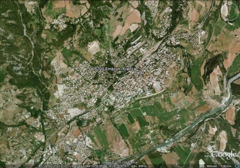
All that is left is two remnants of the fortified past of Embrun: a medieval tower known as the tour Brune (Brown tower) and the governor’s residence, situated on rue de la Liberté. The remaining fortifications were dismantled from 1882 to create urban avenues and construct a railway station. The relief map of 1701, restored in 1783 and 1792, and at a scale of 1/600, is today preserved at the musée des Invalides in Paris.
Embrun
Embrun
44° 34' 50.0358" N, 6° 26' 24.0583" E
Type
urban wall
Department
Hautes-Alpes
Region
Provence-Alpes-Côte d'Azur
Bibliography
- BORNECQUE (R.) et FAUCHERRE (N.), La route des fortifications dans les Alpes, Paris, 2006, éd. Huitième Jour, coll. Les étoiles de Vauban.
- BORNECQUE (R.), Vauban et les Alpes, Saint-Léger-Vauban, 1995, éd. Association des Amis de la Maison Vauban.
- DONNADIEU (A.), Embrun : la cathédrale, la tour Brune et le plan de la ville : guide historique et touristique, Embrun, 1980, 3e éd., éd. P. Ferria.
- HUMBERT (J. général), Embrun et l’Embrunais à travers l’histoire, Gap, 1972, éd. Société d’Etudes des Hautes-Alpes.
- Vauban et ses successeurs en Briançonnais, Paris, 1995, éd. Association Vauban.

