Fort Chapus
History and description
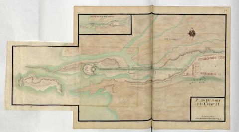
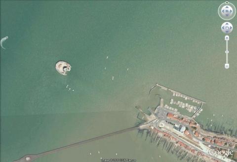
The fort Chapus, also known as the fort Louvois by the residents, was constructed from 1690 on a rock bordering the strait which separates the île of Oléron from the continent. The War Minister Louvois commissioned Michel Begon, Intendant of Rochefort, with the construction, in order to enhance the level of protection for the mooring of Rochefort, in an area that the cannons of the citadel of Oléron could not reach. The fort, the construction of which was entrusted to the engineer Francis Ferry, had to ensure its fire crossed that of the citadelle d’Oléron. The first project of Ferry consisted of an oval-shaped fort, equipped with two stages of cannons and two turrets framing its gate; a submersible roadway at high tide linking it to the mainland. The construction started in January 1691 with the foundations, which made up half the cost of the total construction, given the problems of stability of the subsoil, at the site which was flooded at high tide. On 19 June, 1691, Louvois approved the final project of Ferry but his death a month later led to the project, which had been criticised by Vauban, being abandoned.Opposed to Ferry, Vauban reduced the construction costs with a project for the fort in the form of a horseshoe, including a low semi-circular battery with a central keep, against the ground. He retained the foundations of Ferry, which were completed on 20 October, 1691. The dimensions of the battery were reduced to 52 metres by 55, the height to 12 metres and the number of cannon positions was sixteen. The keep was twenty-four metres high, in a polygon shape towards land and round towards the interior of the fort. This keep included five floors, three of which were vaulted and housed the officers’ quarters and a powder keg. The stairwell was an aid to navigation. A barracks was constructed at the centre of the battery, sleeping quarters for soldiers and the arsenal on the first floor, food stock houses, the cistern for drinking water, and the two canteens on the ground floor. A guardroom and another powder keg were constructed around the barracks. In 1692, the entire first level of the fort was finished and the main structure was completed in 1694.
In 1755-1760, the fort was modified. The cannon emplacements were reduced by half, the latrine-watchtowers were drilled and the roofing on the keep was replaced. The current appearance of the fort reflects these changes. In 1870, the cannons were replaced with six mortars. The garrison was thirty-six soldiers. Blighted by the marshes, the foundations were restored in 1875.
Current state
The fort Chapus still exists today but was subject to significant restoration following the struggle for overall control during the Liberation. In 1960, the town bought it and restored it over twelve years in order to transform it into a natural and historical maritime museum. One of the rooms was dedicated to the fortifications in the region. The fort is open to visitors, alone or with guide, daily from 10am to 6pm during the months of July and August, and only during low tide for the rest of the year.
Fort Chapus
Fort Chapus
45° 51' 25.2457" N, -1° 10' 27.8972" E
Type
coastal fort
Engineers
François Ferry, Sébastien le Prestre de Vauban
Department
Charente-Maritime
Region
Nouvelle-Aquitaine
Bibliography
- LE BLANC (F Y), FAUCHERRE (N.), La route des fortifications en Atlantique. Paris, 2007.
- Fort Louvois, site officiel, http://www.fort-louvois.com/

