Navarrenx
History and description
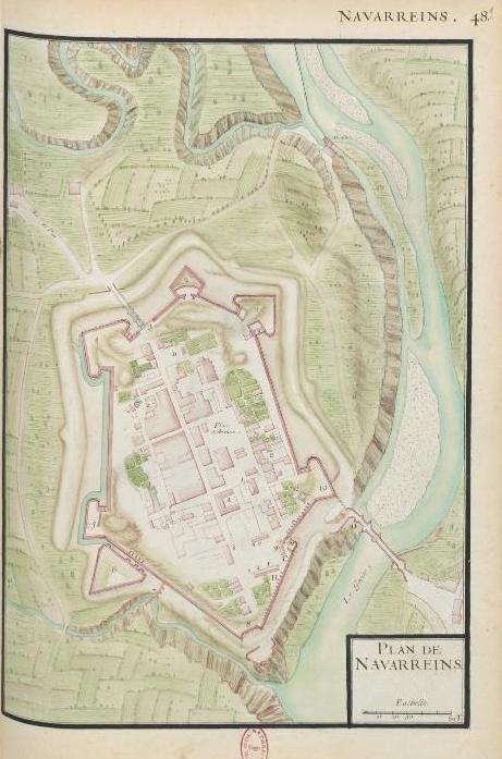
Navarrenx emerged in the 14th century. The presence of a bridge on the Oloron, not far from where it met the stream of Laroderr, prompted the Viscounts of Béarn to construct a first castle fort to control access to the peaks of Somport and Roncevaux in the vicinity (via which access to the kingdom of Navarre, lending its name to the agglomeration, was also possible). In 1316, the initial castle was replaced by a walled town. The site was prominent due to the presence of a rocky spur above the river, and a spring from which 1,700 litres of water per hour emerged in all seasons.The first modern constructions emerged in 1538. Henri II d’Albret, brother-in-law and ally of Francis I, had Navarrenx reconstructed as a bastioned fortress of the Navarre kingdom, to take on the Spain of Charles Quint. The ramparts were designed by the Italian engineer Fabricio Siciliano and the construction was implemented by Francis Girard, a master mason from Bayonne. These constructions were completed around 1547 and were contemporary in comparison to the modernisations of Bayonne and Narbonne. The urban wall included two orillon bastions, two orillon demi-bastions and a ravelin. These were distributed on the campaign front of the ramparts and preceded by dry moats. The flanks situated along the course of the water comprised nothing but a wall, with no other features. A U-shaped arsenal was constructed inside. Between 1550 and 1569, Jeanne d’Albret, daughter of Henri II d’Albret and mother of Henri IV of France, reinforced the defences of the site, which became an inner fortified structure for safeguarding Béarn and the Navarre, as well as a protestant centre. It was therefore able to withstand a French siege in 1569. In 1620, it was taken over by Louis XIII, who proclaimed the union of Béarn with France and restored Catholicism to the site.
In 1680, Vauban or one of his partners proceeded to renovate the urban wall, the appearance of which, however, remained unchanged. New barracks were also constructed.
Current state
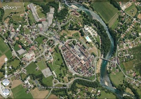
The town has been downgraded since 1868. Two thirds of the ramparts of Navarrenx still remain. The demolished portions were the south-west and north-east front; the curtain walls of which were razed for to make way for new roads. The current bridge, dating from 1583, was repaired multiple times in the 18th and 19th centuries. In 1988, it was restored and enlarged to facilitate motor traffic flow. In the town, the fountain, powder keg and arsenal of the 16th century and the barracks of 1680 still survive and have been transformed into private residences. All can also be visited.
Navarrenx
Navarrenx
43° 19' 22" N, -0° 45' 29" E

